|
  
JPN/ENG/FRN/CHN/KORRegistered trademark: 5445551

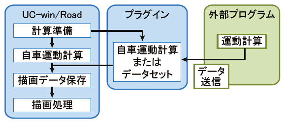
VR-Cloud® is a consensus building solution which uses 3D and VR on
a cloud server. As long as
you are connected to the Internet, you can take control of VR space even on a thin client.
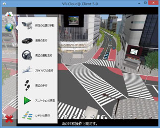
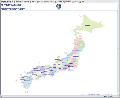
VR-Cloud® Standard
Various kinds of simulation can now be experienced very smoothly by implementing
a unique transmission technology "a3S".
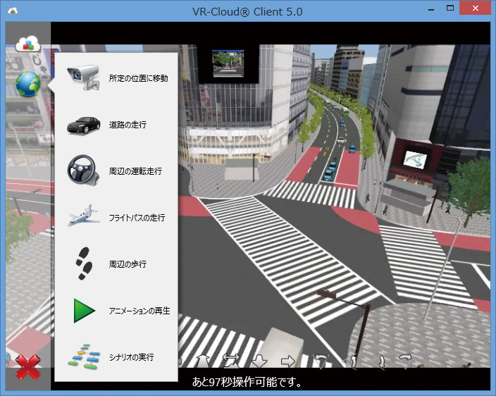
- Operation mode (viewpoint, movement)
Freemode (Free view point position
by interactive)
Various kinds of simulation (road running, Flypass flying and free walking)
Executing a script (Automatic presentation),
and scenario and replaying video
Selection of vehicle model for driving
simulation
Manual driving using keyboard (patent obtained)
- Setting for context (collective setting), traffic flow and preferences
ON/OFF
- Displaying homemenu (data summary, favorite, browsing history)
- Multi client and operation by the acquisition of operation authority have been
supported.
- Client of Android version can acquire the location information using GPS
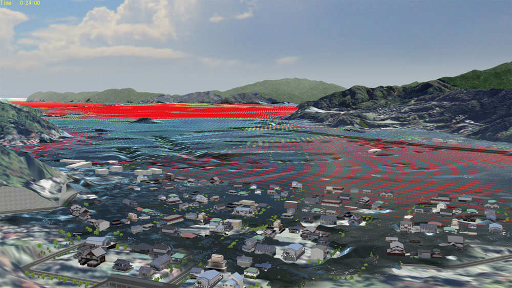
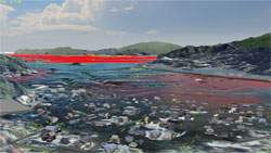
- xpswmm simulation (results of flood and tsunami analysis etc.)
- VR-Cloud® SDK and VR-Cloud® script plug-in
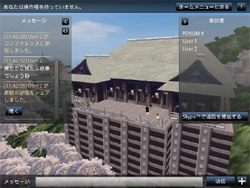
VR-Cloud® Collaboration
Full VR cloud system which anables the hegh quality communication between
clients.
3D bulletin board function
- Creating landscape VR environment
- Display icon and response from the other uses
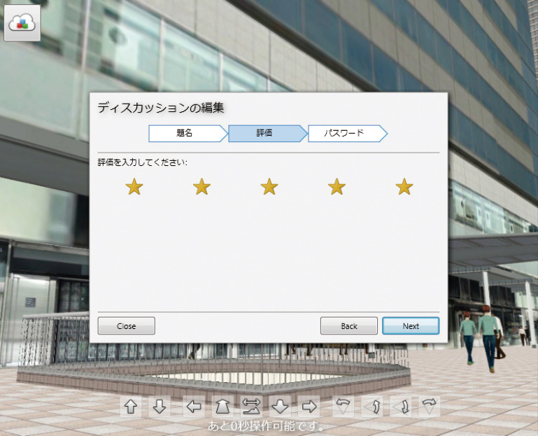
Landscape Evaluation function
- Creating landscape evaluation in VR space with
marking and HTML output of a list
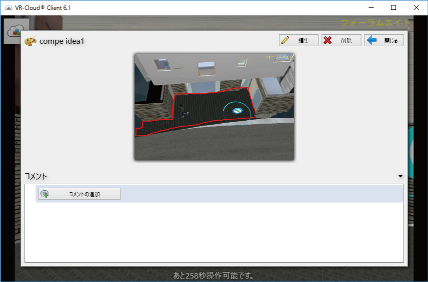
Annotation function
- Comments in the disucussion is displayed as 3D
icon on the location specified in VR space.
 |
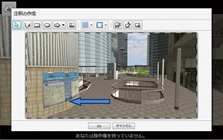 |
| ▲Landscape evaluation |
▲Annotation function |
Photo function
- Displaying icon in 3DVR environment, browsing,
editing and deleting photos are possible.
- Selection of camera position from GPS of AndroidTM
terminal
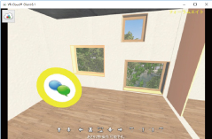
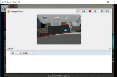
Conference function
- Shere of viewpoint-communication with text, video
and sound
- Access restriction using a pasword
 |
 |
| ▲Photo function |
▲Contents viewer |
VR-Cloud® SDK
The following list indicates what can be achieved by using the scripting
language (AngelScript) and a commercial text editor, importing the program
into the system via the VR-Cloud® script plug-in. The script language is
very similar in structure to C/C++.
- Customizing the user interface of VR-Cloud(R) client such as adding new
menu and buttons.
- Developing many different GUIs each one specific for different content
to be published on-line
- Assigning various different kinds of commands such as those used to change
the camera (viewpoint) position and the environment, as well as commands
used to initiate driving
|
 |
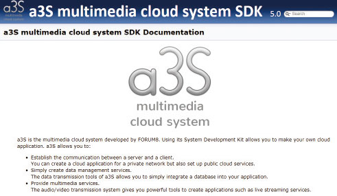
a3s(Anything as a Service) SDK
The a3S (Anything as a Service) Multimedia Cloud System allows you to create
your own cloud applications. It is possible to provide various types of
cloud service by taking advantage of the video/audio streaming technology
and the large-capacity data transmission/reception technology that uses
the high-speed data transmission system.
The Development of a cloud system using our cutting-edge architecture
a3S is FORUM8's in-house developed multimedia cloud technology that allows high quality video
and audio to be supported and streamed between the server and client application, as well as
the high-speed transmission of large-capacity data.
This SDK allows you to use the various functions that a3S has to offer to develop a cloud
computing application.
- Supported Platforms:Windows (Android, Linux, iOS will be supported in the
next version.)
- Development Language:C/C++, DelphiTM
Supports both public cloud and private cloud
- Cloud based data sharing systems and large-capacity data transmission services
- Video hosting and video on-demand services
- Chat features, bulletin boards, and message services
- Cloud based gaming services
- Developing a cloud version of the existing application

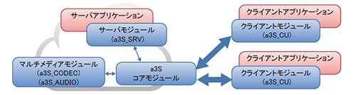
Core modules of a3S multimedia cloud system
a3S Protocol : Connects the core parts controlling TCP protocols, the server and each
and every client. It also controls commands, and manages the synchronization
and authorization system.
a3S Multimedia : Encodes and decodes the videos via the latest video compression techniques,
and enables audio streaming without occupying too much CPU.
a3S Data : Data management system which allows transmission of up to 4 GB of data at one time
Example of creating a system using a3S
VR-Cloud® was developed using a3S technology. This software has the
ability to enable high-quality real-time images and sound, such as that
of moving vehicles, to be sent from a server running the Interactive 3D
VR Simulation software UC-win/Road, to client machines so that they can
share and interact with the 3D VR environment. An individual client's key
strokes, mouse events, and GPS coordinates, as well as images captured
by a camera are sent to the server and they are reflected in UC-win/Road's
3D environment running on the server. The updated content can then be shared
among many other clients.
|
|
Page Top  |
UC-win/Road SDK (Development Kit)
API is provided to customize UC-win/Road. |
The Software Development Kit (SDK) includes Library and API for developing
a plug-in that can run on UC-win/Road as well as the sample program. The
development language is DelphiXE2 (Earlier version than Ver.7 uses Delphi2010).
Using API enables to freely develop the option at the same level as UC-win/Road
basic plug-in.
Products configuration :
| Library folder |
: |
Various library files required to compile the plug-in are stored. |
| Plugins folder |
: |
Source code of various sample programs is stored. Compiling and executing
it would help you understand the features that are controllable in SDK. |
| UIL folder |
: |
Framework required for creating UC-win/Road plug-in is stored. |
| Help file |
: |
Available only in English. |
API functions : Editing, reading and writing data
| Terrain |
: |
GRID / Patch (TIN) |
Aerial
Photo |
: |
White and read the aerial photo |
| Road |
: |
Horizontal alignment, Longitudinal alignment, Obtaining shape of 3D model,
Cross section, Bridge space, Tunnel space, Section interpolation, Texture |
| Intersection |
: |
Stop points, Texture, Assignment of traffic signals, Percentage of cars
Turning left, right, and going straight, Traffic control (traffic light
etc.) |
| Traffic |
: |
Traffic volume, Setting of vehicles' disappearance and generation,
Setting of traffic profile and vehicle group |
| Model |
: |
Placing models |
Development of various input and output plug-in :
Data linkage with the software developed by your own is feasible.
<Development Case>
 |
 |
 |
 Exodus plug-in Exodus plug-in |
xpswmm plug-in |
Display road map plug-in |
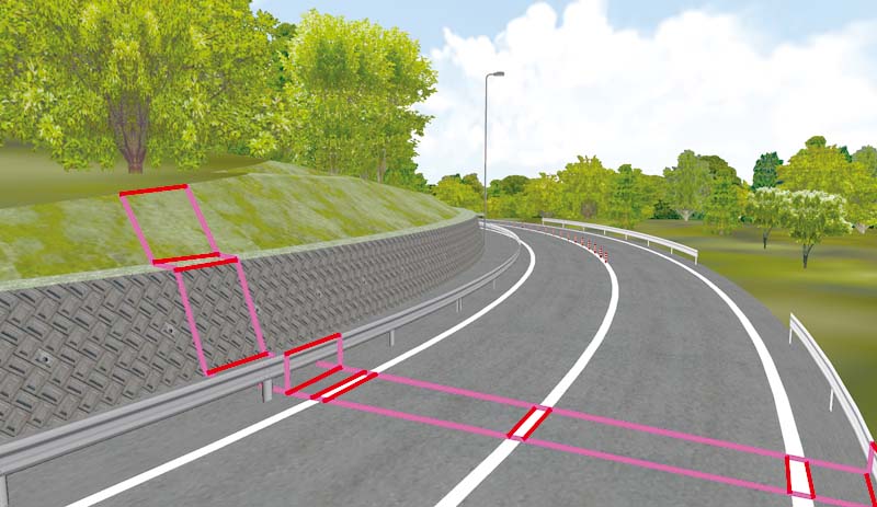
Sample Program
Program to assign various conditions of the traffic flow. "Traffic
Generator Set" is added to tool menu. Clicking this allows to add
"Optional traffic volume point" on the center of each
road to allow you to assign basic traffic conditions. Traffic generation
points on the edge of each road can also be assigned.
*Please contact FORUM8 if you require customization development
|
Browse and change static data that comprise the whole VR environment.
 |
 |
 |
| Terrain |
Model |
Road alignment |
Control model/character in real-time
 |
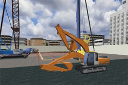 |
| Control coordinates of a character |
Control one of movable parts |
Control Driving Simulation
Control camera position in the main window
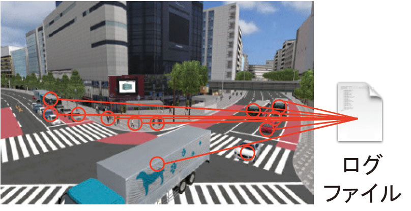
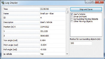
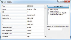
Logging function
Creative drawing via OpenGL control
Features on GUI (Graphical User Interface)
 |
 |
 |
| Addition of input/log display window |
Add a new control option |
|
| UC-win/Road Free Viewer |
|
This free viewer product allows you to move around the 3D environment as
well as play and replay scripts. Data file exported from UC-win/Road Free
Viewer Export Plug-in (US$750) can be imported and browsed.
- RD data designed especially for the Free Viewer version can be browsed for free.
- This is a basically a Presentation version with limited features. Data
and scenarios cannot be created.
- The software can be downloaded from the User Information Page (go to Download Service link after logging in). You can login to this
page from the top page of the official FORUM8 website by entering in your
Usercode and Password.
|
|
| UC-win/Road Presentation Version |
Product delivery styles Useful presentation version is available!
|
With UC-win/Road, there is a presentation version (52,500 yen). VR features
available are similar to UC-win/Road. A variety of visual option functions
allows you to do various simulations. With delivery in AVI file, a screen
view is recorded through the AVI option feature (84,000 yen) and, if necessary,
it can be mixed with voice or music using Premier (Adobe) and such. When
directly printing out other captured images, it is recommended that you
do so in a higher resolution.(Example of maximum resolution: 4096x1536
pixels when dual screens are used) |
 |
|
UC-win/Road Educational Version Education software for creating VR
Target: Primary students, Junior high school student, High school students (under 18) |
| "3D virtual reality creation educational software" available
for Primary students, Junior high school students, High school students,
and students aged 18 or younger. Just as with the standard version of UC-win/Road,
you can create a city and its infrastructure in 3-dimensional virtual reality
(VR) on your computer, and drive in it ? and if you have a steering wheel,
driving in manual is also possible. You can also download data made by
other users and view them, making it a useful simulation software product
for designing and building city models. |
Popular with youngsters!
UC-win/Road Driving Simulator |
VR data server
Data browsing / web operation
View
Registration
Retrieval
|
Product Configuration
- UC-win/Road Advanced base.Web match-up mode
- Data compatibility with UC-win/Road is not supported.
- UC-win/Road DB is available during effective period of maintenance contract.
- Web registration of UC-win/Road data (Stop motions x 2, descriptions).
- Data registered by users can be available
Additional Options
- UC-win/Road Driving Simulator Plug-in
- UC-win/Road Eco-Drive Plug-in
- UC-win/Road Data Exchange Tool
Separately Sold Hardware
|
 |
|
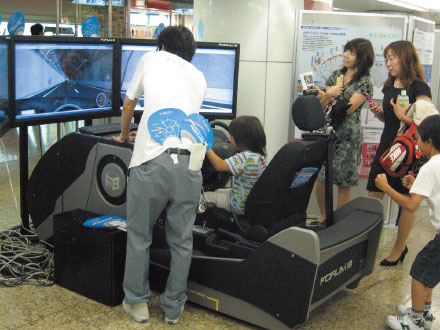
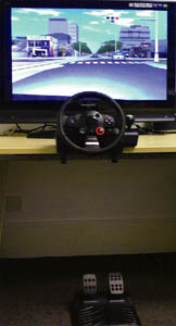
A Driving Simulation Package that lets you feel the real driving sensation as you hold onto the wheel which is fairly easy to control. |
VR-Drive provides an economical way to educate young people in the art
of road safety by offering students the opportunity to drive in a 3D Virtual
Environment and experience real life everyday driving scenarios.
ECO drive plug-in is installed on it and carbon footprint data in the form
of CO2 emissions and fuel consumption are calculated after each drive and
the printed report shows how the driver has performed.
Hardware
- VR-Drive software, Logitec steering system for game, PC with graphic card
are required.
Customization
- VR-Drive consists of 3D environment and the driving scenario designed with traffic specialist.The customization of 3D environment can be flexibly performed, and the specific driving can be generated as you specify. (Estimation is required separately)
Interactive driving scenario
- The driving scenario under bad conditions (pedestrian, bicycle driver,
left-turn, right-turn, road with poor visibility) are predefined in VR-Drive.The
young driver can experience the realistic road with the driving scenario.
Built-in of optional data
- If you have data for VR-Drive, it can be embedded instead of standard data.
In addition, by selecting scenarios to use and setting course information
such as course title, course images, and description, users of UC-win/Road
can create data supported by VR-Drive.
Eco drive report
- The report of CO2 emission amount and the fuel consumption is created for
each driving.The young driver can learn the preciousness of human life
and the contribution for the environment.
-
|
 |
|
|
|
|
UC-win/Road Data Exchange Tool
The tool collection for DXF Data exchange, SIMA Data exchange, 3D model
exchange, Horizontal alignment IP calculation, Tunnel cross section calculation
in UC-win/Road |
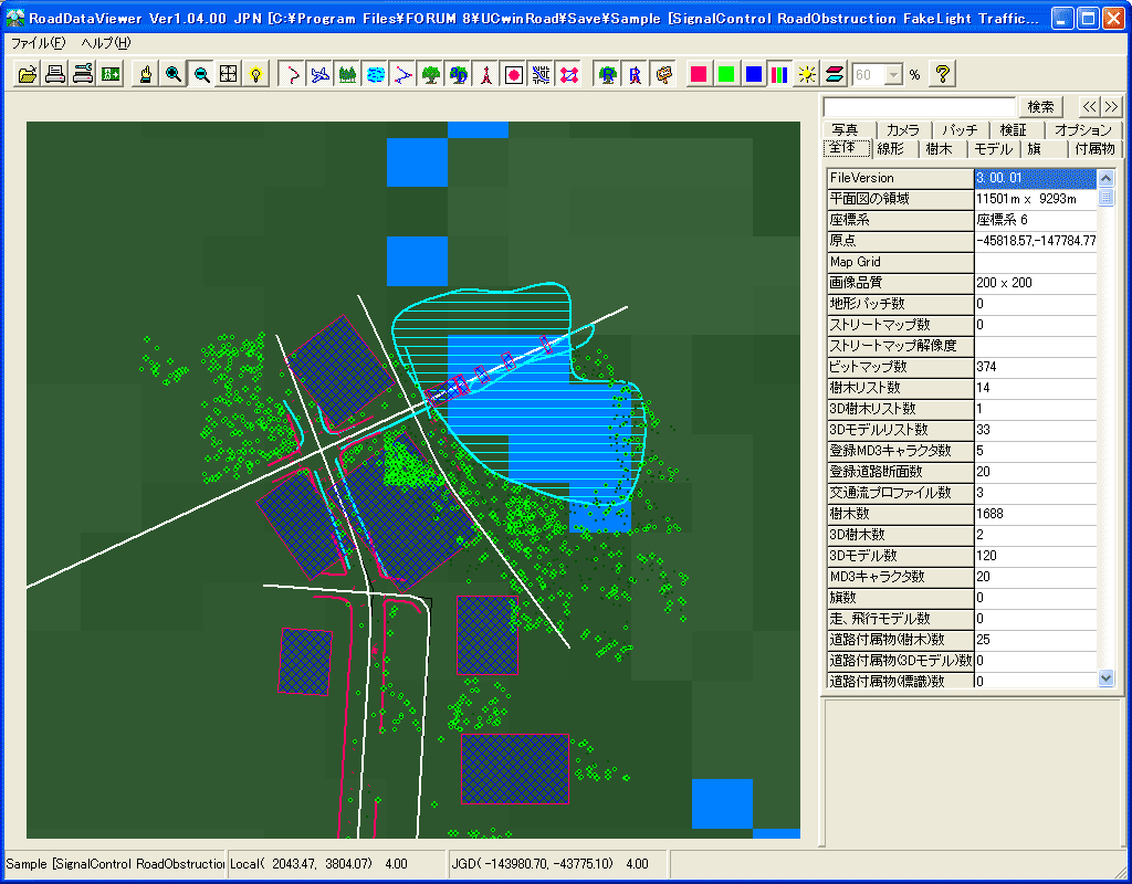
Road Data Viewer
- Verification feature
- A total number of pixels of texture
- Unconnected road connecting point
- Embedded models, overlapping arrangement, arrangement outside of range
- Feature for creating Report / Road alignment basic input table
- Creates reports and linear standard input lists with the OpenOffice.org or Excel templete. PDF export of the report including 3D capture data is also supported (Acrobat3D is required).
- Create terrain patch data
- Pastes raster images, generates altitude points, and creates terrain patch
data. Contours in a blank map can be trased.
SIMA Data exchange tool
Supports SIMA common format Ver.3 (C04: Curve element attribute data).
You can also export data to road cross section data file (*.rs).
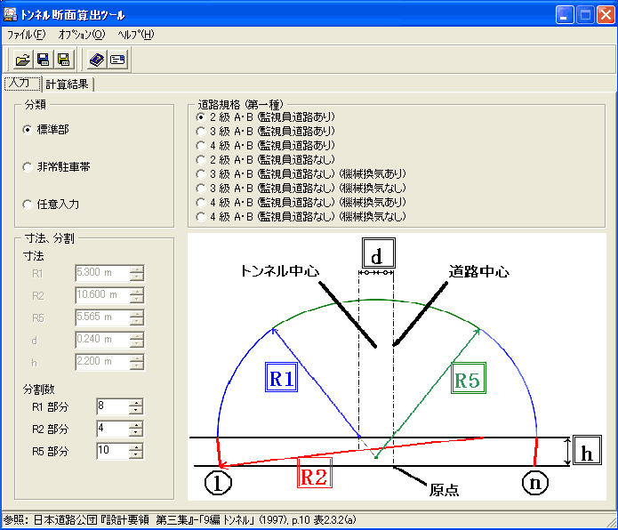
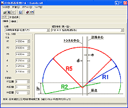
Tunnel cross section calculation tool
A program that calculates tunnel’s cross sectional shape based on the standard
established by the Japan Highway Public Corporation, and converts to UC-win/Road's
road cross section file.
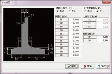
Civil engineering 3D model creation tool (Parametric)
This program allows the creation of a 3D model by entering the parameters for each structure, and exporting it as a 3D Studio file (*.3ds).
|
Tunnel section calculator |
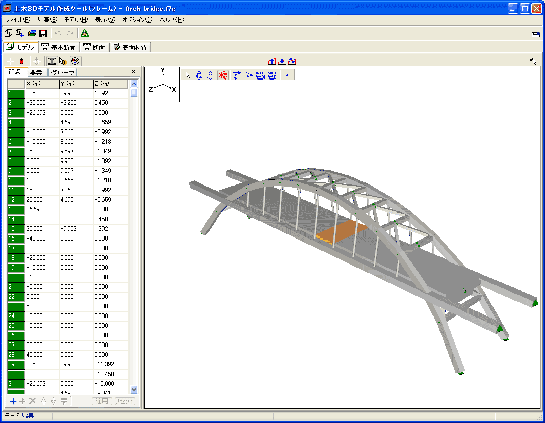
Civil engineering 3D model creation tool (Frame)
3D model creation assistance tool via generator. Models can be created
using frames and section, same way models are created in UC-win/FRAME(3D).
 |

|
Civil engineering 3D model
creation tool (parametric)
|
Civil engineering 3D model
creation tool (frame)
|
GeoMap3D Data exchange tool
3DS models can be converted to a format common to 3DS models of stratum
data exported from Geomap3D. Ground surface can be converted to UC-win/Road
terrain patch data.
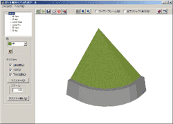
Embankment edge 3D model creation tool
3D model creation tool that creates embankment edge using a cone that constitute
one fourth of a regular embankment. The model of the embankment edge can
be easily created by defining each dimensions whilst referencing the visual
shape.
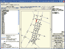
Horizontal alignment IP calculation tool
A program that calculates an IP point required when defining roads in UC-win/Road
from a turning point on the horizontal alignment from horizontal calculation
report.
|
|
|
Embankment edge 3D model
creation tool |
3D model exchange tool
You can convert UC-win/Road’s 3D model terrain patch file to a 3DS file
format.
DXF Data exchange tool
Converts DXF data including terrain data to UC-win/Road terrain data XML
fomat.
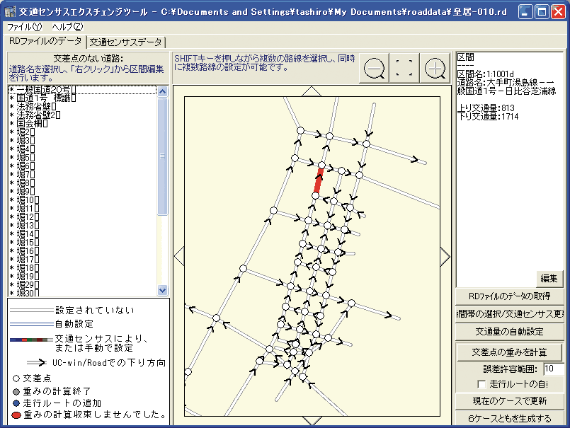
VR Simulation data creation tool based on traffic census (under development)
Traffic information from road traffic census (by CD version and Japan Society
Traffic Engineerings ) can be assigned to UC-win/Road's traffic volume/profile.Traffic
volume at different days and time of day can be assigned to each road can
be assigned together with your choice of vehicles to be put on traffic.
The development of a weighting feature is also planned.
|
 |
JPN/ENG/KRN/CHN(Simple/Traditional) available
Registered trademark No. 5132945 |
Large scale data
- This does not have a limit on the scale of data, you can create large scale
data of over 100km. You can add terrain area. VR-Studio(TM) has 50m mesh
DEM data. (use of survey data is approved by Geographical Survey Institute)
Multi reality
- This function allows comparing of multiple plans. All of the models, or
part of the models can be switched to another condition-reality. It allows
examining multiple marking plans of intersections, comparing road alignments
and comparing house developments and other plans.
Multiuser editing
- VR-Studio allows the editing of one project by multi users. Users can share
the data with the source management server, and manage store and synchronize.
By using management server, complete editing history can be recorded and
edited.
Traffic simulation function
- Because you can export or import between the projects, you can reduce cost
and time of data production.
 |
 |
 |
|
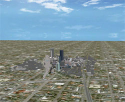 |
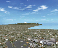
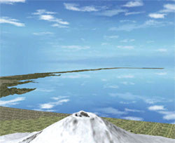
Performing fly through from Tokyo->over the Mt. Fuji ->
to the center of Nagoya in stress-free |
|
|
| Page Top |
| Books related to UC-win/Road |
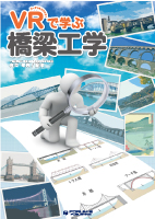
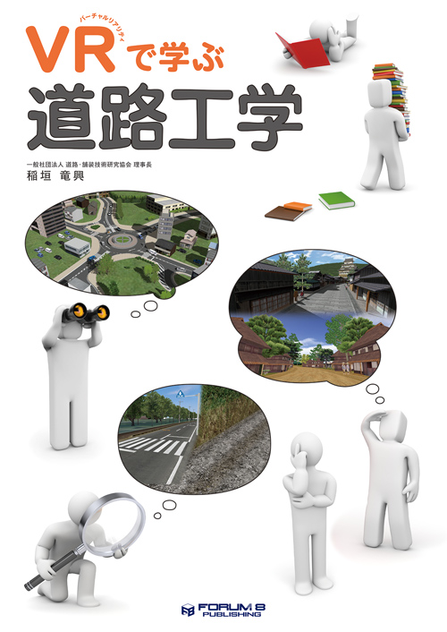
| Learning Bridge Engineering Through VR
|
The number of bridge longer than 2 m in Japan is 700 thousand for road
bridge and 90 thousand for railroad bridge, most of them were built in
the high economic growth period. Those bridges require maintenance because
many of them are getting older. It is expected that people who read this
book become a fan of bridge as that of railroads, and more people come
to know how to take care of bridges.
| Author |
: |
President of Pave & Road How-To Way Technology Association (Paroway Tec)
|
| Date of publication |
: |
November 2017 |
| Price |
: |
3,800 yen (tax exclusive) |
| Publisher |
: |
FORUM8 Publishing |
|
 |
|
|
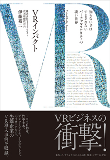
| "VR Impact" Amazing world of virtual reality that you must know
(Japanese)
|
The first year of VR started in 2016, and VR technologies are being applied
to a lot of businesses. This book introduces the history of Forum8 having
worked on the most advanced technology since it released the 3D virtual
reality software UC-win/Road in 2000. A variety of VR case examples of
user companies such as TOYOTA, Takenaka Civil Engineering & Construction,
Denso IT Laboratory, and PIONEER are explained. The author writes his try
and future prospect to support Japanese industry by VR and to continue
creating new technologies as a software company.
| Author |
: |
Yuji Ito (President & CEO, Forum8) |
| Date of publication |
: |
May 25, 2017 |
| Price |
: |
1,500 yen (tax exclusive) |
| Publisher |
: |
Diamond Business Planning (Saller: DIAMOND, Inc.) |
|
|
|
|
| Learning Road & Pavement Construction Engineering Through VR (Japanese) |
Japan has pavements that is about 6 thousands km long and 60 trillion yen as total assets. This technical book is a collaboration of digital and analog for whom wants to understand, think, and evaluate this pavement, and make it as a new business.
| Author |
: |
Tatsuoki Inagaki
President of Pave & Road How-To Way Technology Association (Paroway Tec) |
| Date of publication |
: |
November 2016 |
| Price |
: |
3,800 yen (tax exclusive) |
| Publisher |
: |
FORUM8 Publishing Group |
|
|
|
|
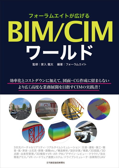
| BIM & CIM world expanded by FORUM8 (Japanese) |
"What we can do by CIM" will increase by a variety of solutions of FORUM8 such as CIM tool including UC-win/Road, UC-1 series and systems linked with VR and hardware! In addition to for efficiency and cost reduction, this CIM practice book is for advanced and wide business development more than figure and CG creation.
| Editor |
: |
Ryuta Ieiri |
| Author |
: |
FORUM8 |
| Date of publication |
: |
November 2016 |
| Price |
: |
2,500 yen (tax exclusive) |
| Publisher |
: |
Kensetsutsusin Shimbun Corporation |
| Seller |
: |
FORUM8 Publishing Group |
|
|
|
|
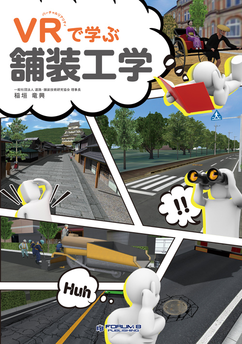
| Learning Road Engineering through VR (Japanese) |
This book with a whole new concept explains state of the art information like ICT and CIM in addition to basic contents about road engineering, written by Mr. Inagaki renowned for easy explanation to understand in his existing books.
| Author |
: |
Tatsuoki Inagaki
President of Pave & Road How-To Way Technology Association (Paroway Tec) |
| Date of publication |
: |
November 19, 2015 |
| Price |
: |
3,800 yen (tax exclusive) |
| Publisher |
: |
FORUM8 Publishing Group |
|
|
|
|
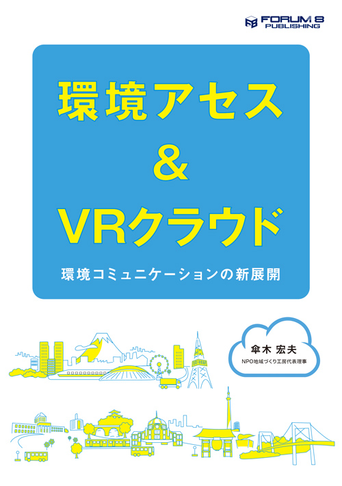
Environmental Assessment & VR Cloud
-Novel development of environmental communication- (Japanese) |
Explanations and study cases about environmental assessment method and
its development by using 3D VR and the cloud in the purpose of considering
better ways of business that matches the characteristics of the area and
making good communications between business operators and residents.
| Author |
: |
Hiroo Kasagi
CEO of NPO Workshop for Sustainable Community
Executive board member of Japan Society for Impact Assessment |
| Date of publication |
: |
November 19, 2015 |
| Price |
: |
2,800 yen (tax exclusive) |
| Publisher |
: |
FORUM8 Publishing Group |
|
|
|
|
| Introduction to Earthquake Disaster Mitigation (Japanese) |
This is a textbook/manual for entry level scholars and engineers to learn
the fundamental technologies of tsunami engineering, seismic engineering,
and urban disaster.
Editor : Hiromichi Yoshikawa (Prof. of Tokyo City University)
Author : Harumi Yashiro, Seiichiro Fukushima, Hideto Omine, Makoto Hada
Date of publication : April 15, 2013
Pric : \3,000(tax exclusive)
Publisher : FORUM8 Publishing Group |
|
|

|
|
|
Introduction to Android Programming
- The basics of Smartphone application development on Linux and 3D VR Application
programming - (Japanese) |
This is an introductory book for learning the basics of Android Application
development and the method of developing and programming Android Application
for VR-Cloud® client using abundant sample data.
Author : FORUM8
Published date : November 30th 2012
Price : \1,500(Before tax)
Publisher : FORUM8 Publishing Group |
|
Special supplements DVD
E-book version (PDF)
/ Sample program included |
|
 
|
|
| Introduction to LibreOffice for Engineers (Japanese) |
This is a book from which engineers can learn the basic information related
to Office software by reading, in order to gain their IT literacy.
Author : FORUM8
Published date : September 1st 2012
Price : \1,500(Before tax)
Publisher : FORUM8 Publishing Group |
|
Special supplements DVD
E-book version(PDF)
LibreOffice3.6
/Collection of LibreOffice templates
Sample data used in this book
/ Collection of convenient freeware |
|

|
|
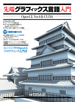
The introductory guide of the advanced graphic language
-Open GL Ver.4 & CUDA- (Japanese) |
Introductory book for civil construction engineers to learn the graphics
programming using OpenGL
This book is for the civil construction engineers with the experience of programming to learn the graphics programming and parallel programming. It explains the OpenGL programming using SDK(System Development Kit) of VR(UC-win/Road) and the advanced parallel graphic language including CUDA. This book consists of simple structure with the contents of programming, many flow charts. In addition, the many reference images are introduced in case studies.
| Author |
: |
Kensuke Yasuhuku, Assistant Professor of Cyber media center in Osaka University
/ Hiromu Ito/ Kenpou Okuma/ Tadato Ishikawa/ Pencreach Yoann
(FORUM8-VR development group) |
| Published date |
: |
November 16th 2011 on sale |
| Price |
: |
\3,480(Before tax) |
| Publisher |
: |
FORUM8 Publishing Group |
|
|
Sapecial supplements DVD
E-book version/UC-win/Road Ver.6 trial version / Open GL Sample Program
/ UC-win/Road SDK Sample Program / CUDA Sample Program |
|
| Programming for civil engineer (Japanese) |
Utilization of SDK in VR structure analysis learning with Delphi
This is the introductory book for less-experienced civil engineers to learn
programming with SDK(System Development Kit). The simulation using VR software,
UC-win/Road has been marked in the laboratory of university or research
institute. We will propose the utilization of solver for structural analysis.
This book includes the trial version where the sample data can be available.
It consists of a variety of diagram
and images such as the contents of programming and flow chart to be simple
to understand. |

|
| Published date |
: |
November 19th 2010 release |
| Price |
: |
\2,940(Before tax) |
| Publisher |
: |
Nikkei BP Inc. |
|
|
DVD-ROM included
Delphi2010 trial version
/ FRAME(2D) SDK sample program
Multiframe automation sample program |
|
|
"Construction engineering software series: VR case studies for construction
project"(Chinese)
"Educational material of UC-win/Road by Shenzhen Tsinghua Sware
Software" |
"Construction engineering software series : VR case studies for construction
project" was issued in July 2010 by FORUM8's dealer in China, Shenzhen
Tsinghua Sware Software.
In this book, it shows how to create the VR simulation project with UC-win/Road
using the actual VR project and advanced use of UC-win/Road.
 Created by VR group of Sware Created by VR group of Sware |
  |
|
|
| Manual for utilization of UC-win/Road (Chinese) |
Introductory book in Chinese version, learning 3D space creation with VR
and VR simulation techniques
It is decided that "Manual for utilization of UC-win/Road" Chinese version will be issued by China Architectural Construction Publishing.
The operation of 3D virtual reality software, UC-win/Road and the data creation method are explained in detail. A variety of case studies in each area are introduced, this book will be effective for the beginners who learn 3D landscape creation and VR simulation techniques. It will be useful for not only the beginners but also the professionals who want to brush up their data creation level. |
CD-ROM included Ver.3.4 Trial version
| Published date |
: |
2010 |
| Price |
: |
RNB 88 CNY |
| Publisher |
: |
China Architectural Construction Publishing |
| Editorial supervisor |
: |
Prof. Ma Zhiliang, Tsinghua University, Dept. of Engineering |
| Original authors |
: |
|
| Editorial supervisor |
: |
Shigenori Tanaka |
| Editorial adviser |
: |
Yuji Ito, Chikako Takei |
| Author |
: |
Kantaro Monobe, Hiroya Yoshida,
Satoshi Ishida, Masayoshi Taniguchi, Yuki Torigata |
|
 |
|
| VR Presentation Technique (Japanese) |
This book became the latest unique VR technical specialty journal which described VR case example, VR modeling and presentation.
Opening Interview: Special contributed article by Mr. Tadao Ando
"Case example of VR presentation" |
|
| Published date |
: |
November 19, 2008 |
 |
| Price |
: |
\3,990(Before tax) |
| Publisher |
: |
X-Knowledge Co., Ltd |
|
|
CD-ROM included :
Ver.3.4 Trial version |
|
|
| UC-win/Road Introduction (Japanese) |
| This is a simple introduction book which comment on from the summary of
UC-win/Road to how to create data and how to run a simulation. |
CD-ROM included : UC-win/Road Ver.3.2 Trial version
| Publisher |
: |
Kenstu Shinbunsya publication |
| Price |
: |
\3,980 (Before tax) |
| Editor |
: |
Kansai University Faculty of Informatics Prof Tanaka Shigenori |
|
|
|
| UC-win/Road Video Tutorial (Japanese) |
Japanese / English / Chinese / Korean
Price: \30,000(Before tax)
This is a video about UC-win/Road guidance. It gives us visual lectures
with sounds how to create data and use other methods. |
|
|
|
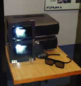
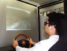
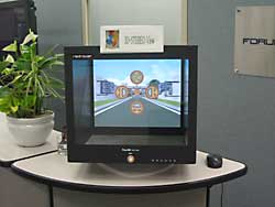
 UC-win/Road 3D Stereo View Price: separately estimated UC-win/Road 3D Stereo View Price: separately estimated |
Supported by the UC-win/Road Ver.4 or newer version
Social demanding of 3D Stereo View is increasing against the background of the technical infrastructure of hardware.
UC-win/Road 3D Stereo View allows you to output the VR data by the UC-win/Road into the data in 3D stereo view data format.
It will be used for researches, developments and amusement, as well as VR creation, driving simulation through the 3D stereo view. |
 |
Support both methods: Polarizing Projection (Passive)
using binocular parallax and Active.
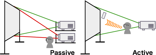 |
Example of 3D Stereo View System Configuration
Example of Polarizing Projection (Passive Method)
- Set two projectors to overlay displays.
- Project through the polarizing filter.
- Set the distance between two eyes or the focal distance through the UC-win/Road Stereo Option
- Project on the silver screen and wear the polarizing glass, and you will
be able to see the 3D stereo image.
Hardware Requirements
- Polarizing Projection (Passive Method)
-Silver Screen Projector (two units) / Projector rack / polarizing filters
for projector (two pieces)
-Polarizing filter Glass / 3D Video Card: Two output terminal (Two Video Card Configuration is recommended.)
- Active Stereo Projection
-Standard White Screen Stereo Projector (one unit) / synchronized emitter
-Active Glass nVIDIA Quadro
|
3D Display Plug-in
True3Di 19 inch monitor SDM-190M Redrover Japan Co.,Ltd.
It provides 3D work environment as
well as many 3D applications.
| Aspect ratio |
SXGA |
| Resolution |
1280x1024 |
| Active Display area(mm,typ) |
376.32(H)*301.056(V) |
| Color number |
16.7M |
| Response Time(ms) |
5 |
| Dimensions(WxHxD)mm |
452x467x418 |
| Input Signal(2ports) |
AnalogRGB,DVI |
| Weight(Kg,lbs) |
30Kg,66.1lbs |
|
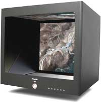 |
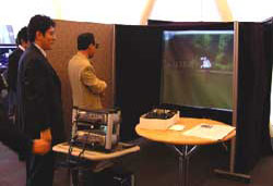
Exhibited at FORUM8 Tokyo head office |
Same contents (UC-win/Road) |
|
|
|
| Page Top |

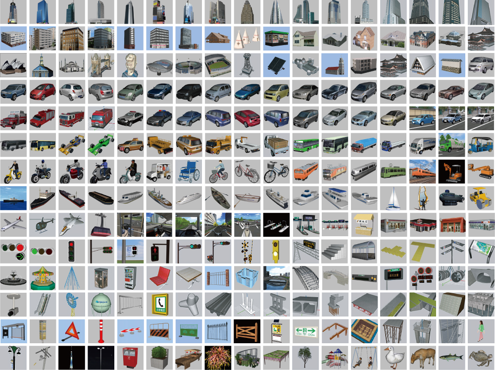
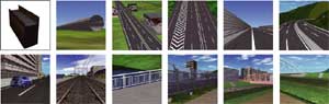
VR Model Internet Database
Use the Internet with this database of 3D models, textures and section
data.
Direct downloading from the product is available.
* Free of Charge with maintenance and support products
Passenger vehicle having headlight, businessman model, tree textures have
been added.
Number of registrations (2012.01.06):
*3D models: 3378 ; textures: 3824 ; section : 67 ; sample data : 55
|
| ●VR model DB |
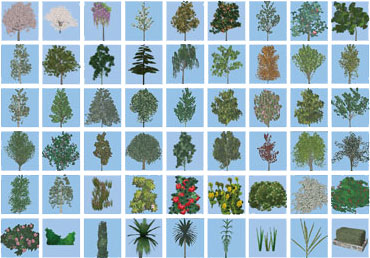
| 3D 2D Trees |
3D tree |
leaves / bark / flowers |
| 2D tree |
tall evergreen trees / evergreen trees / evergreen shrubs / tall deciduous trees / deciduous trees / deciduous shrubs / tall flowering trees / flowering trees / flowering shrubs / house plants |
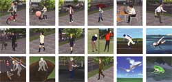
MD3 character
human models |
characters / animals / humans |
Vehicles /
Equipment /
Running models |
Road vehicles |
passenger cars / trucks / trailers / cabs / buses and taxis / bicycles / motorcycles / special vehicles |
| 3D cockpit |
| Railway vehicle |
high speed trains / ordinary trains / monorails |
| Airports / harbors / river facilities |
port facilities / harbor signal equipment / rivers / flood control facilities |
| Aviation / marine vessel, construction heavy duty equipment, temporary
equipment |
Building /
Facility /
Structure model |
Building / House /
Store / Steel tower |
office building (super high-rise) / (med to low-rise) / building (low-rise) / condominium apartment / general home / store / market / industrial facility/public facility / transmission tower |
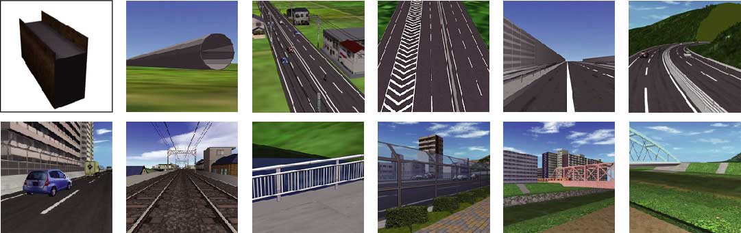
| Railroad / road structure |
bridge superstructure / bridge substructure / road structure / gate pier / pedestrian bridge / traffic sign pole / marking |
| Railroad / road facility |
bridge superstructure / sign / alarm equipment / station / street light / others / road regulatory equipment / road accident |
| Park facility |
playground equipment / building / others |
| Others |
sign / traffic control / disaster / others |
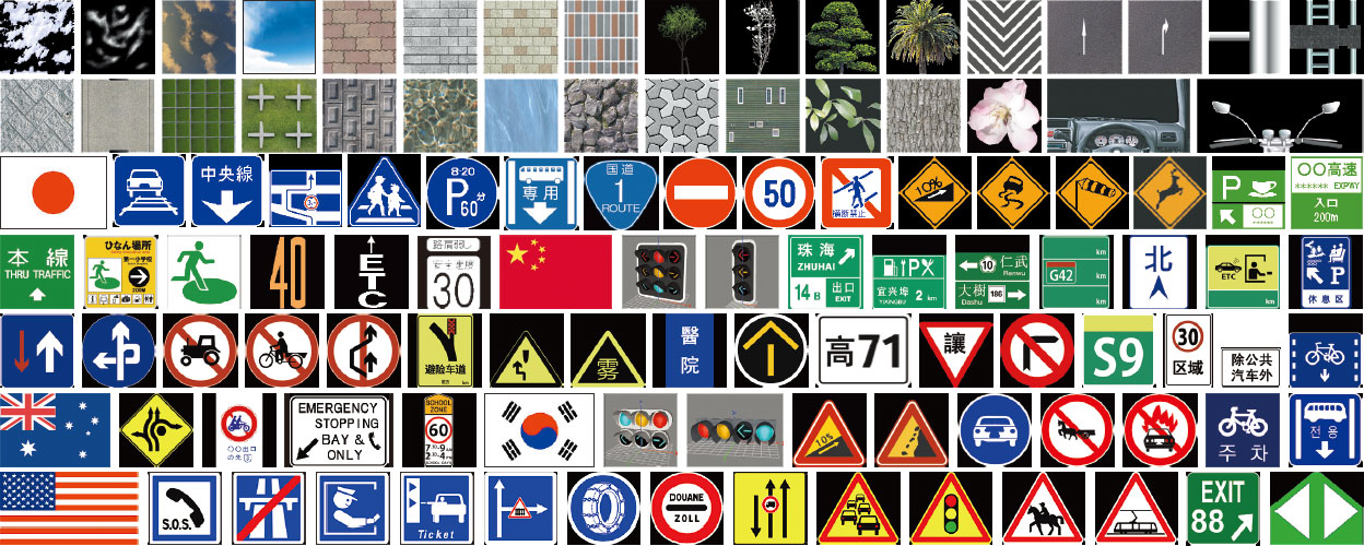
*Road / Traffic /
Traffic sign texture |
Paved road / railroad surface |
pavement surface / railroad surface / others |
| Banking / cutting |
planting / concrete block / concrete blasting / others |
| guardrail / curb / footpath |
| Bridge |
truss / beam bridge |
| Tunnel, intersection |
| Traffic sign |
indication sign / regulatory sign / guide sign / warning sign / auxiliary
sign / railroad sign / Signs abroad (Korean / Chinese / U.S.A. / New Zealand
/ French / Malaysian / U.K. / Thai / Netherlands / Ireland / Vietnam /
Germany / India / Singapore / Spain / Colombia / Brazil / Finland / Australia
/ Turkey / Lebanon / Poland / Portugal / Sweden / Switzerland / Iceland
/ Italy / Austria / Philippines / Taiwan) |
| Marking |
indication marking / Regulatory marking / others / Korean road marking / Chinese road marking |
| Background |
super high-rise building group / mid to low building group/ low-rise building group/ forest / fence / others |
| Building, river, cockpit, sky, flag, terrain, water surface, fire and smoke,
others |

By using abundant standard models, data generation can be effectively performed,
allowing use of the model editing tool and action settings of the models
through easy operations. The UC-1 design series can be loaded and the structure
models designed using UC-win and import textured 3DS-format models generated
with other 3-D tools.
It exports from other UC-1 Series, UC-win series, and external 3D tools.
|

3-D tree data exclusively prepared for UC-win/Road. Diverse features such
as leaves and branches swaying in the wind, growth simulation, and such
are available.
|

Textures such as a cross section form, a road surface, a pavement are available
as it is.
|

Excellent default textures of slopes, excavations, road surfaces, pavements,
walls and such are available. Sky and landforms can be mapped in default,
and many special textures such as trees and signs can be arranged with
their dedicated commands. The cockpit while cruising can be used as a texture.
|

UC-win/Road VR data download (supports for world heritage)

|
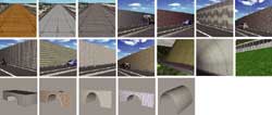
| Construction methods |
It supports textures for construction methods.(Data provided by HIROSE&Co.,
Ltd)
*HIROSE&Co., Ltd has the copyrights of texture (photo image) |
|
 |
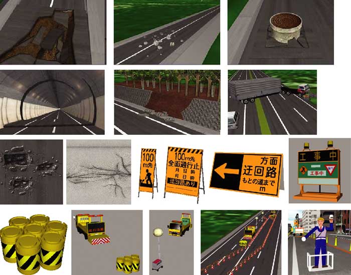
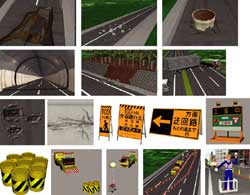
| Disaster/Regulations |
It supports model/texture for road hazard simulation. (Data provided by
Road Management Technology Center)
*This database is provided having permission from Road Management Technology
Center. |
|
 |
 Air photograph (Digital orthophotos) Air photograph (Digital orthophotos)
- Air photograph (Digital orthophotos) now on sale! Reading in UC-win/Road
is available
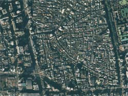
It's the product of Nakanihon Air Service CO., LTD. (http://www.nnk.co.jp/research/product/data/aerophoto.html) which covered whole of country.
It's now on sale by 4,000 yen (incl. 4,200 yen) / Km2(Simple Oltu)
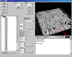
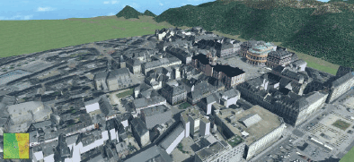
3D building model for UC-win/Road
- 3D building model service for UC-win/Road
3D building geometric model which can be used by UC-win/Road is sold.
Highly precise three-dimensional data based on an airborne laser counting
system
- ""Terrain Model""+""Solid Model""
data which make 6km2・9km2 1 lot.
- XML(UC-win/Road topographic format)/offer by DXF form
- Service area: Main area of Kanto, Tyubu, Kansai and a city designated by
ordinance(About 10,000km2)
3D building data/topographic data original data price: 100,000 yen / km2
Fabrication for UC-win/Road 3D building data 150,000 yen / km2
(Reduction of polygon, layers separated(For texture), elimination of feature
such as unnecessary trees.)
Sales unit: *1 mesh: About 1km2 9km2(3rd mesh)、 6km2(3rd mesh)
 |
|
 |
| UC-win/Road read screen |
|
UC-win/Road 3DVR expressed image |
|
|
| Page Top |
|
|