
| Large scale multi VR |
Following the release of the VR Studio(R) ver1.0, FORUM 8 is set to release VR StudioTM ver1.1, which has improved features from the previous version. This version has revisions including the data creation function and improved performance. Major revisions are as follows.
- Background processing
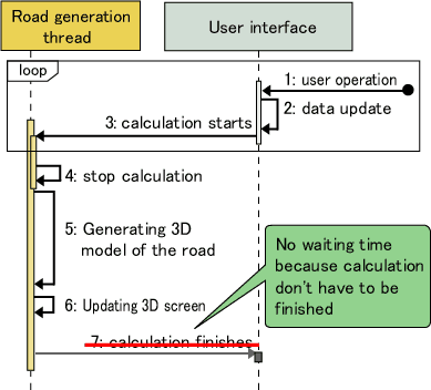
With VR-Studio, a 3D road model is being created while the users are editing the road. It allows users to check the newly created road in an instant. Using this function, the multi thread option of VR Studio is applied to the road generation process. While users are editing the road, another thread is generating the road. With this separate process, response of the editing screen becomes improved and allows users to operate seamlessly without being affected by the systemfs road generation process.
- Improved view control
 3D mouse automatic connection:
Users can always use a 3D mouse in the 3D view. In addition, while using the editing screen, except for the main screen, users can check the 3D shape by using the 3D mouse.
 Spin modeF
In the 3D view, users can see the view revolving around the selected model. It is very useful when users wish to view the position of the model and also for making presentations.
 View settingF
From the plain editing screen, users can check and set the view.
- Improved vertical cross section alignment editing screen
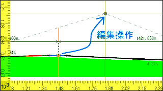
When there is a cross road on the road you are making, you can check the point of the crossing. It allows this whether the intersection can be generated. The intersection has been made successfully by seeing the change in colour. It is useful to adjust the vertical cross section alignment. The new version also shows bridges and tunnels more clearly. When you edit the transition point of the section by the mouse, you can check the vertical cross section which is expressed with a broken line.
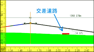
 Intersection on vertical cross section alignment
 Editing vertical cross section alignment
- Resource management, quick filtering function
Each resource can be copied or output to files. Users can change the name directly where the reduced resource is displayed. On the resource management, resource selection, and table editor, quick filtering function allows you to see the selected items by entering only part of the name. When you have a lot items to input, this function can be used as a quick retrieval function.
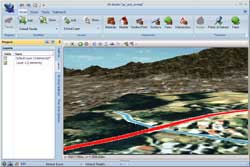
- Aerial photography, street map
In the latest version, users can use the multiple pictures on the screen by setting the photo end pixel to transparent. It allows you to edit the horizontal alignment of the road with overlaid drawings on the pictures. Other revisions include the newly added grid display function for the picture editing screen and the improved usability when setting the position in the grid and the photo selection.
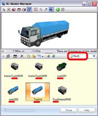
 Quick filtering function
 Combination of aerial photography and street map
- 3D model LOD
For the improved performance, users can set 4 level LOD(Level of Detail) for 3D models.
 What is the LOD for?
The further the view becomes, the wider the displayed area becomes and the number of models displayed increases. In the remote view, the LOD level changes to keep the drawing speed with the high resolution. By showing the elaborate model in accordance with the size on the screen VR Studio enables high quality and high performance at the same time.
 Case of LOD:
For example, in the close up view of the building, each one of the columns is displayed in the highest level, while the 2D image of the columns are displayed in the remote view to reduce the number of the polygon. If you change the 3D columns to the 2D image using enough distance so not to be noticed, you can keep the balance of the display quality and performance.
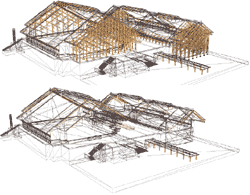
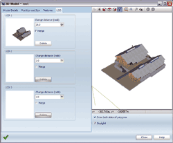
 Setting Screen
- Anti-aliasing
Anti-aliasing process is available on 3D screen and editing screen. You can see the improved quality on the 3D screen and the editing screen. Without the anti-aliasing, the color of the polygon is described by the pixel. It leads to the step-like roof line of the building, this occurs if the polygon or the boundary line is not set to the horizontal or vertical of the screen. Anti-aliasing processing is generally used to avoid this.
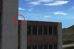
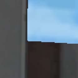
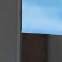
 Screen shot of the building: enhanced image of the red-circled part shown
right
 Not anti-aliased
 Anti-aliased
