Program Overview
 |
|
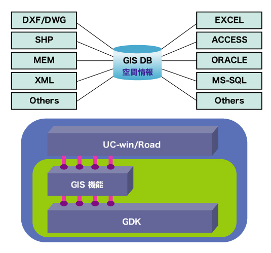
3D/GIS Solution UC-win/Road for GIS
Use of various kinds of database information
- This plug-in allows you to build the 3D GIS system by importing the 2D
/ 3D data from road CAD, GIS software and various 3D CAD software.
Various kinds of method to publish
Function Overview
- Coordinate conversions for GIS format files
- Import / Export image files
- Import / Export the vector files
- Attribute table conversion function
Import :
Shape file
MEM file (Numerical value map 50m mesh issued by Geographical Survey
Institute Authorisation)
XML file(UC-win/Raad data)
DXF file
slm, slp sal, XML(Numerical value map 25,000 / 2,500 data issued by
Geographical Survey Institute Authorisation)
TIFF
Export :
Shape file
DXF file
- Linkage between GIS file and UC-win/Road
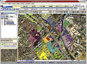
| Seismic Hazard Distribution Map / GIS |
>>ちょっと教えたいお話 Seismic Hazard Distribution Map(Up&Coming '08 Early Spring Issue)
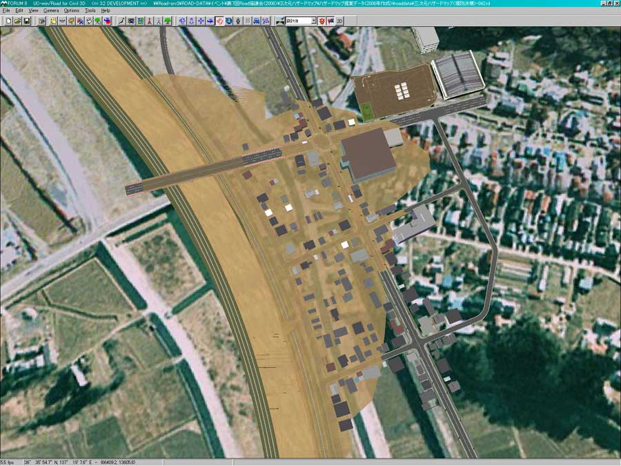
UC-win/Road for GIS enables you to import GIS standard Shape file as 3D
urban city and road. 3D simulation which is linked with GIS of flooding,
evacuation, tsunami and architecture plans. Support service to create the
various kinds of hazard maps including the seismic hazard distribution
map etc. can be provided. FORUM8 can help you with various kinds of your
business including planning for architectural construction, energy simulation,
CAD software and even system development etc.
What is "Seismic Hazard Distribution Map"?
"Seismic Hazard Distribution Map" is one of the disaster prevention maps introduced by Cabinet Office in Japan. The seismic hazard of the area is evaluated from both of the ground situation and possible earthquake as the intensity scale (Note 1) and residents expresses their own resident area on a perceptible scale in detail. This will enable residents to find out information of the earthquake in advance, enhance consciousness of disaster prevention, recognize their own resident area and realize the risk in the event of an earthquake. Usually these maps can be easily created via GIS software (Geographic Information System). |
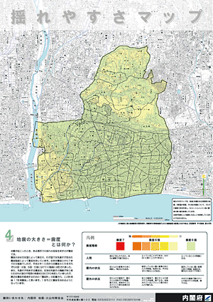

The earthquake disaster prevention map in Chigasaki City (1)
Extract taken from
Seismic Hazard Distribution Map |
|
|
| Service to create the seismic hazard distribution map |
|
The Article 7 of Special Measures concerning Earthquake Disaster Management
says the prefectural and city governments have to try to disseminate the
matters concerning the degree of earthquake disaster etc. to residents
to mitigate the disaster due to the predictable earthquake etc. in the
area. The map warning people in the area of the dangers due to an earthquake
is called Disaster Prevention Map and it is considered that showing the
earthquake prevention map will be effective as a means to let the residents
know about the dangers. The improvement in each prefecture or city has
been encouraged and FORUM8 has also provided this service.
GIS software "GEOMania" has been provided. 3D hazard map provides VR model via UC-win/Road. |
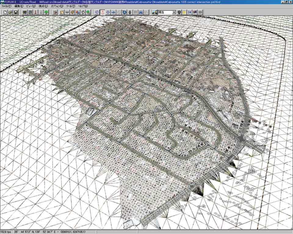
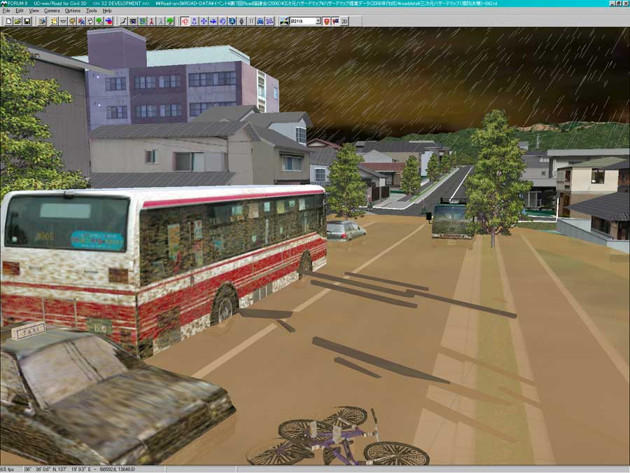
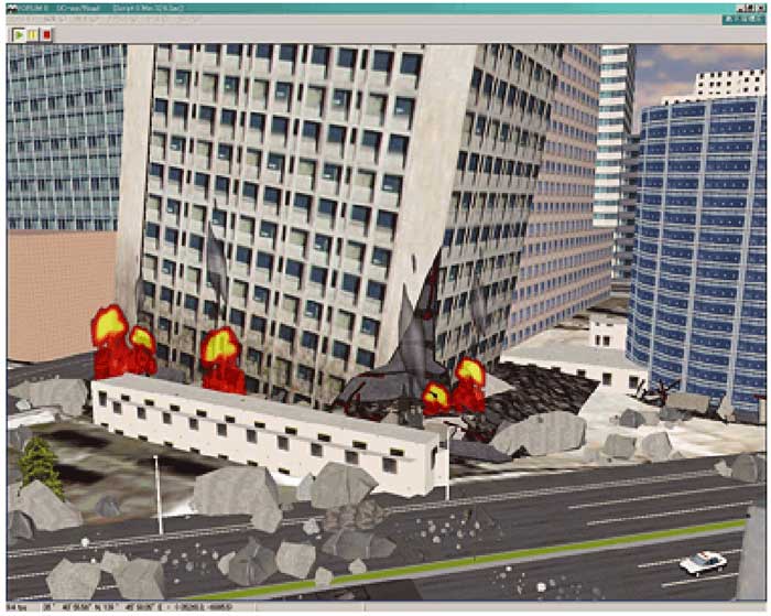
| 3D GIS / Disaster Simulation System |
|
UC-win/Road for GIS enables you to import GIS standard Shape file as 3D
urban city and road. 3D simulation which is linked with GIS for flooding,
evacuation, tsunami and architecture plans can be run.
(Road Management Technology Center, 2004-2005) |
|
|
|