 UC-win/Road UC-win/Road  UC-win/Road Support System UC-win/Road Support System
|
 |
|
|
| ( The following pictures use UC-win/Road
Ver.3.1 new function "POV-Ray Option."
) |
 |
 |
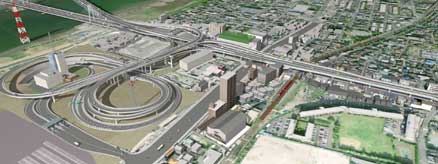
| Simulation carried out at the Daishi junctionand
ventilation place
|
| Kanagawa Construction Bureau, Metropolitan
Expressway Company Limited |
|
Content :
The line traversing Kawasaki City (the first) is planned to strengthen
the communication with the city and the center of Tokyo and the other
central cities which are the central business cities in the
metropolitan region, and is under construction now by Metropolitan
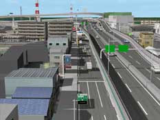
Expressway Co.,Ltd. Among that, the Daishi junction has become the
complicated form where the high level roads and the semi- underground
roads congest. Depending, in order to deepen the commonness recognition
of everyone of the local residents who take part in this construction
and the persons concerned with the business, we created a 3DVR which
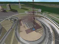
begins the car simulation. In addition, Daishi ventilation place built
in a loop, makes simulation to be aimed for the common property of the
image with the applying companies when they order technical suggestions
constructions. It is used in the construction summary presentation, and
serves to connect with the better technology suggestions by securing
the situation of the construction place. |
 |
 |
 |
|
|
 |
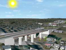
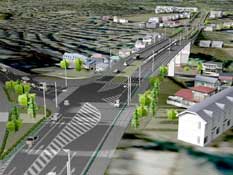
Machida city,
Aibara-Tsuruma line simulation
|
Bureau of Construction Tokyo Metropolitan Government
Minami Tama Higashibu Construction Office/
Japan Bridge & Structure Institute, Inc. |
|
Content :
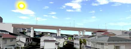
Before the city planning road development of Machida city, we created
the VR data and the AVI animation on the basis of the VR data as a
document for explanation to the local residents. Concerning the local
products in the surrounding of the planned bridges, we created the 3
dimensional models on the basis of local reports. About the sunlight
study which uses the data which are completed, we did the study using
the UC-win/Road visual option-shadow option and captured the animation.
We created the document for editing the AVI on the basis of the
animation. Using the functions such as the visual option in addition to
the practical use as the ordinary VR data which utilizes the traffic
flow expressions, it became a document for more effective presentation. |
 |
 |
 |
|
|
 |
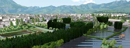
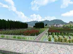
The Simulation of Ecological
Restoration of Yunnan Province Erhai Lakeside Area
|
| China Shanghai Institute of Waterways |
|
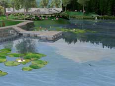
Content :
Erhai Lake is located to the Yunnan Province (similar to the Japanese
Lake Biwa,), water contamination gets worse by influx such as decrease
and life draining of water level. For that, as a business model, they
made ecological restoration construction for of the environment and the
ecological protection. 3DVR was used in the summary of this
construction to explain the effect. This data reproduced the terrain of
this area to real as a contour line. From various points of view, we
made the simulation of the procedure of the development, the texture of
the models is original, the 3D trees and the fake light are fine. In
addition, it expressed the effect due to environmental improvement,
including the circumstances like fishes swimming. In conclusion, for
making the AVI, music is inserted, added also the explanation with the
sound. As a public information, we can use an AVI animation in future. |
 |
 |
 |
|
|
 |
The VR simulation for the landscape comparison of
International avenue transit mall
|
Nihon University College of Science and Technology Department of
Transportation Engineering and Socio-Technology |
|
Content :
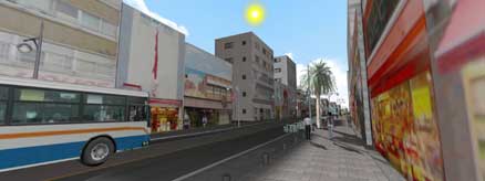
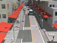
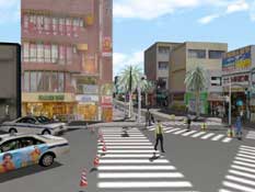
It is a VR simulation of the transit mall done with the social
experiment of the international avenue in Okinawa prefecture Naha city.
The transit mall is expected for a real execution from the spring of
next year. This VR simulation was created to compare and examine
visually various measures during the execution of the transit mall. By
this data, we compare the division methods (color of the pavement,
color combination, planting etc) and eaves on the sidewalk, the
roadside trees. |
 |
 |
 |
|
|
 |
2010, Shanghai international exhibition central
axis simulation
|
| China Nepoch Consultant Co. Ltd |
|
Content :
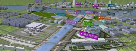
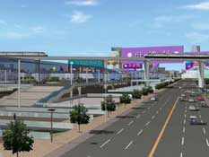
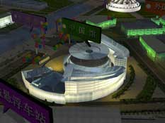
The Shanghai international exhibition in 2010 expresses the main street
town of the international exhibition symbol and its underground space,
and we use a 3DVR to have the concrete recognition by the opening image
for each concerned institution.
In order to express the opening theme of the Shanghai international
exhibition "Better City Better Life", the main street has become the
arcade designed in the shape of an opened umbrella, with a unique
lighting. Using the CAD plan, we created the street map for
UC-win/Road, and excepted the main roads, we use the main functions
that can express in UC-win/Road such as modeling of symbol
architecture, sand guards execution method of an underground, a linear
motor car, operation setting such as subways, a rial flag function of
the flags of all nations, expression of a fake light, a flow of people,
setting of traffic flow. |
 |
 |
 |
|
|


